07:00 PM
Office Club, Berlin
07:15 PM
Processing and presenting drone data in an open source spatial data infrastructure
by Christian Kuntzsch – WhereGroup
Mapbender is a graduated project of the Open Source Geospatial Foundation (OSGeo). It is a web based content management system, used to display, edit, overlay and manage distributed Web Map Services. Mapbender suits the need of distributing spatial data to many users. It is used by small municipalities and large companies as well. Mapbender is also a perfect fit for making available large amounts of aerial photographs, captured by unmanned aerial vehicles (UAVs). The presentation will give a quick overview of a basic and advanced Mapbender application, integrating processed UAV data. We will also show a conceptual workflow of processing raw UAV data and generating point clouds, digital elevation models and orthorectified imagery using OpenDroneMap, „an open source toolkit for processing aerial drone imagery“. Download Presentation here: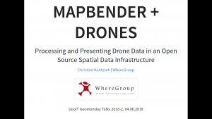
07:45 PM
Management, Analysis, and Visualisation of Information in Scientific Infrastructures
Download Presentation here: 2018-06-04-GfZ-RainerHäner Abstract: Current developments in scientific infrastructures like the European Plate Observing System (EPOS) reveal a very high variety regarding the amount, the kind of data as well as a very high degree of heterogeneity concerning their processing and visualisation interfaces provided by the data suppliers. They also show a still present lack of standardisation concerning the encoding of data, metadata, and semantic information, partly due to a proliferation of domain and even application specific encodings. It is for this reason that one of the most challenging problems regarding the development of scientific infrastructures is to enable collaboration and interoperability across system and domain boundaries. Collaboration in this context not only means that information can be simply exchanged, but moreover that it can be further processed and thus easily, discovered (visualisation), utilised (analysis), and integrated (management) into existing workflows. Interoperability is the key factor in establishing scientific research environments and infrastructures, as well as in bringing together heterogeneous, geographically distributed risk management, monitoring, and early warning systems. Based on developments within EPOS, a reference architecture has been devised that comprises architectural blue-prints and interoperability models regarding the specification of business processes and logic as well as the management (e.g., encoding) of data, metadata, and semantics. The reference architecture supports analysing (Data Mining) both, static and real-time data in order to find correlations of disparate information that do not at first appear to be intuitively obvious: Analysed data (e.g., seismological monitoring) can be enhanced with relationships discovered by associating them (Data Fusion) with other data (e.g., Creepmeter monitoring), with digital models of geological structures, or with the simulation of geological processes. The presentation illustrates the utilisation of standardised statistical analysis and visualisation methods:- Kriging (Subsurface Management)
- Tsunami simulation (Early Warning Systems)
- Prediction of tsunami arrival times
- Generation of time series for virtual and real sensor locations
- Time series analysis (Monitoring, Risk Management)
- Trend detection
- Correlation with Models and Simulation
- Spatial Cluster Analysis of earthquakes (Risk Management)
- Trend Analysis of land displacement (Risk Management)
- Neural Network Clustering of signals in borehole measurements (Virtual Research Environment)
08:15 PM
Optimizing public transport with crowdsourced smartphone data
by Dr. Robert Schönduwe – MotionTag
MotionTags initial idea was to create an intelligent location analytics tool for infrastructure providers. Through advanced smartphone sensor analytics and machine learning, we can identify how, when and where a user is traveling. By using our products clients could learn from the mobility of their users while we could improve our technology. But why stop here when this could improve the lives of numerous people? We have used the acquired learnings to develop our vision: creating a seamless pay-as-you-go ticketing solution. Traveling should be seamless and should not be stressful as it can be nowadays. We are currently piloting our ticketing solution that will enable public transport to compete in the future with new mobility offerings. We think the future of transportation lies in easy traveling, achieved by seamlessly combining different transport modes. Further information: https://motion-tag.com/.08:45 PM
Macroscopic Patterns in Sparse Location Data
by Dr. Peter Ruppel , Bianca Lüders ,
Lüders, Ruppel - 2018 - Macroscopic Patterns in Sparse Location Data Identifying Mobility Prototypes Ubiquitous computing and location-based services are key enablers for gaining novel insights into human movement behavior on a large scale. When searching for patterns in movement behavior, several approaches have been proposed to compare location trajectories or semantic overlaps. This talk and paper introduces the notion of mobility prototypes, which describe human mobility behavior at a macroscopic level and express its most significant characteristics. Based on a dataset of coarse spatiotemporal data from almost 4000 mobile users of a locationbased service over a period of 14 days, we outline a comprehensive and systematic pipeline for processing and exploiting mobility traces and provide insights into the mobility behavior in the city of Berlin. We present a framework to characterize individual users precisely by employing a novel combination of discriminative features capturing the macroscopic mobility behavior, without revealing their identity or actual whereabouts, and define mobility prototypes by constructing clusters of users. The results yield valuable insights into the variety of human mobility and open up new possibilities for future mobile services.